My own POIs, Distance and Area Measurement
You can find your own POIs and Area Measurement in Geo Measure
Geo Measure Area Calculator allows you to measure the distance between different points on the map. It is also possible to manually add your own POIs on the map, share them, and use them to find GPS coordinates.
You can find both tools in the bottom right corner of the screen.
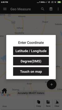
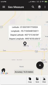
With this tool, you can find GPS coordinates and also add custom POIs. To create your own POIs click on the Tools button in the bottom right corner ( + icon ), select the option POI, and then click on the desired area on the map. You can also check your own POI by just one tap on the Google Map.
You can also save your own POI. The GPS coordinates of the POI are also displayed immediately.
Each custom POI can be Saved, Shared, and also exported in a KML file. You can create more POIs by just tapping on the map. Individual POIs can be moved on the map using drag-and-drop. Location and GPS coordinates will be automatically recalculated.
The POIs added on the map are not permanent, you can save your POIs, and then none can see your measurement.
Distance Measurement:
The tool for manual measurement allows you to measure the distance between two points on the map.
To create points, click the + icon at the bottom right corner of the screen and select Distance and Area Measurement.
a new point by clicking and dragging an added point or a line segment.
From the first selected point, the distance is calculated to the mouse pointer, so for measuring the distance between two points there is no need to select the second point, just tap on the screen and the distance will be continuously modified and displayed.
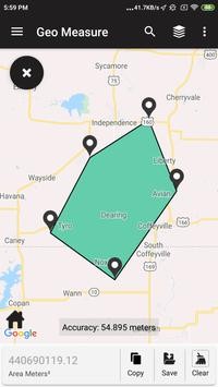
Area Measurement:
If you specify more than two points with the measurement tool, the area is displayed next to the length of the specified path. It is not necessary to close the measured area, the tool automatically connects the first and the last point.